Award-winning
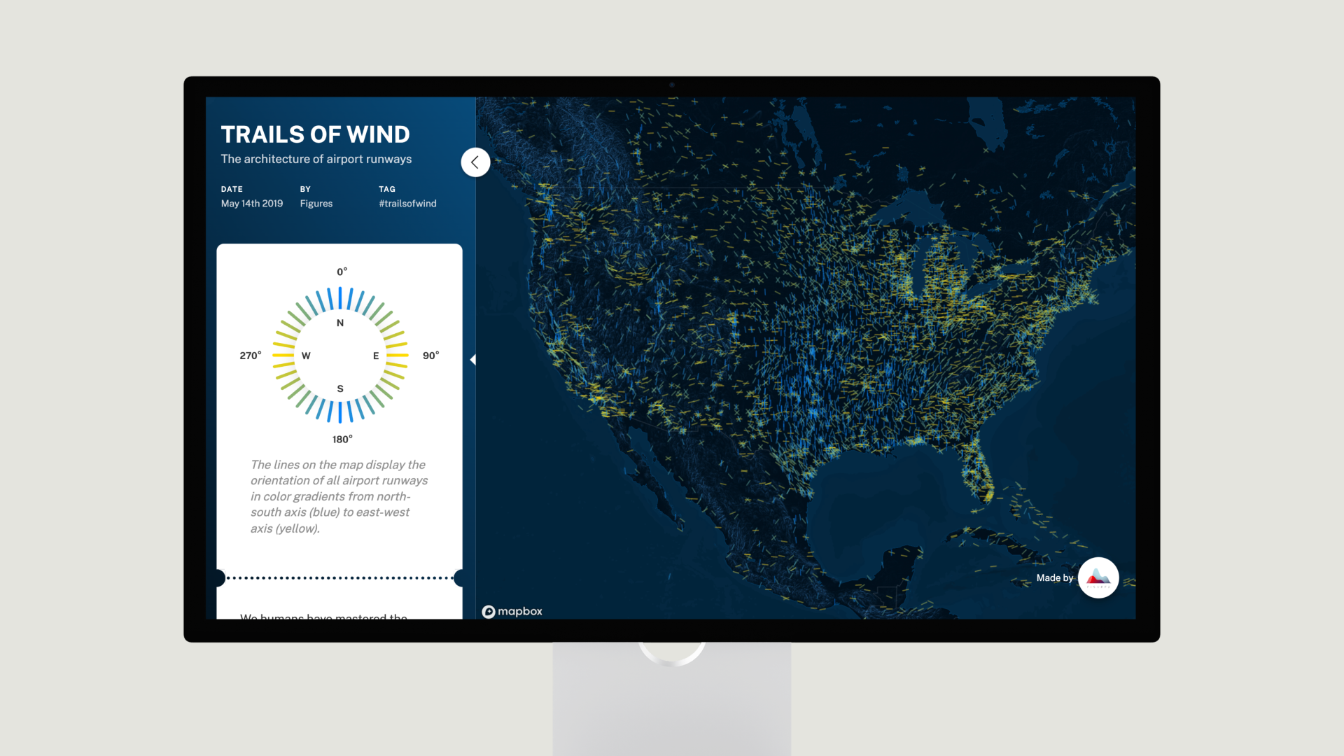
Trails of Wind
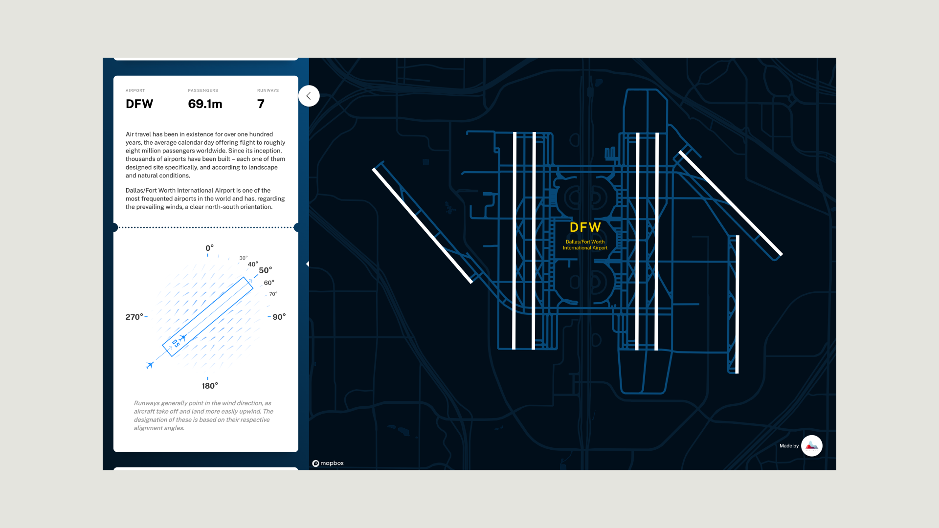
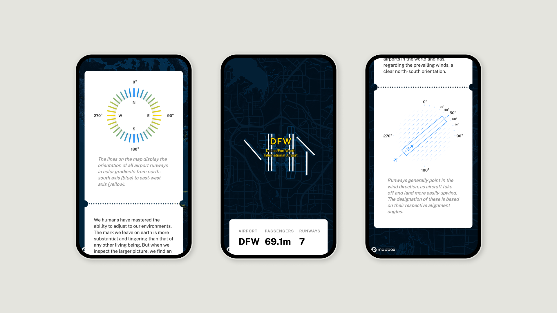
An interactive data story that analyzes the global patterns of airport runways from an aerial perspective. By aligning the runways with the prevailing regional wind direction, a wind map of the entire Earth emerges in the macro perspective.
Project features:
- Data Storytelling
- Interactive App
- Services: Concept, Data Visualization, Web Development
- Award: Information is Beautiful Shortlist